The construction of a Roman camp and the forts that replaced it was a standard repeatable process with adaptations allowed to accommodate local conditions. A soldier new to a fort would immediately know the location of key buildings due to the similar layout and identical street names. A common digression from the standard was in the placement of the gates which met existing roads or natural barriers rather than being spaced centrally in the fort walls. Forts would have 2 to 6 gates. Housesteads had four with one important gate added through Hadrian's wall just east of the fort.
|
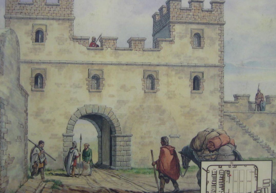
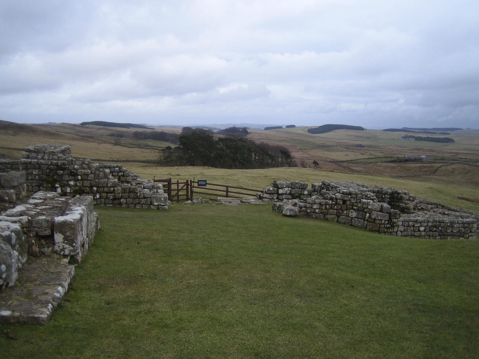
Above is a picture of the fort's formal entrance called the porta praetirua, the east gate. The road in front leads down Via Praetoria and terminates in front of the imposing headquarters, reminding visitors even in this remote frontier fort of the power of Rome. Most gates were built with two arched entrances with one often closed off later as depicted here. Below is the east gate as it appears today:
 |
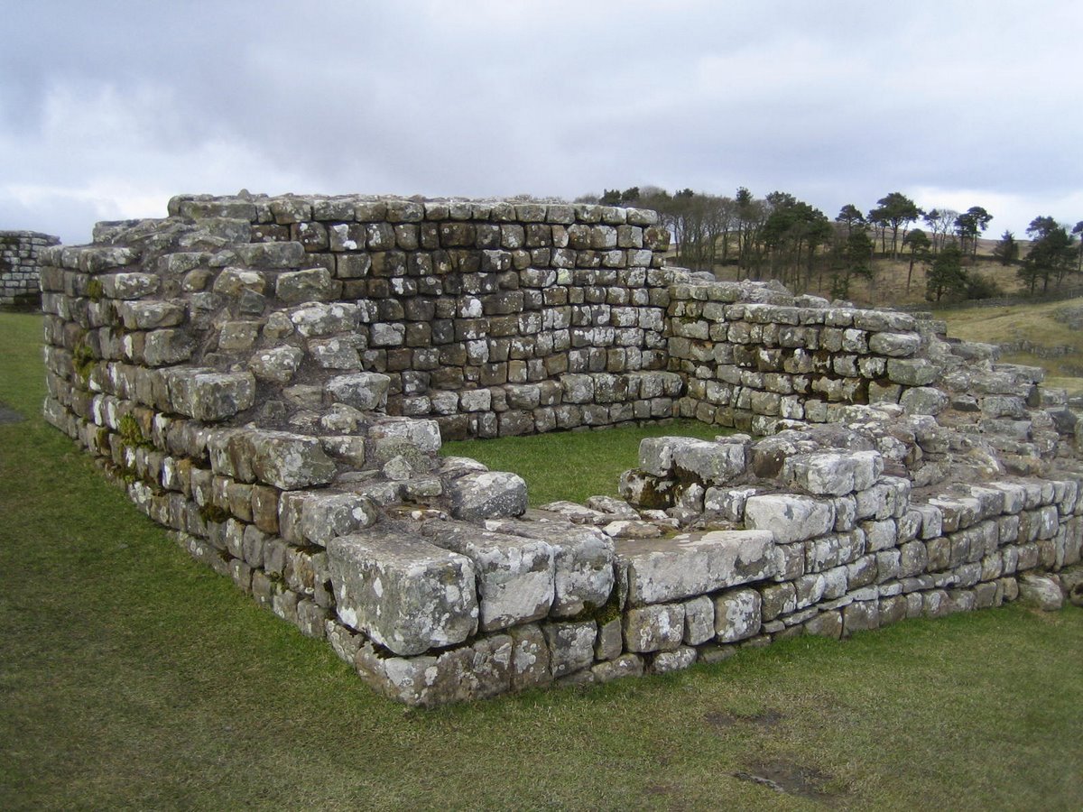
Here's another picture of northern room of the east gate which, when excavated, was found to contain coal used to heat water for the Roman bath nearby.
 |
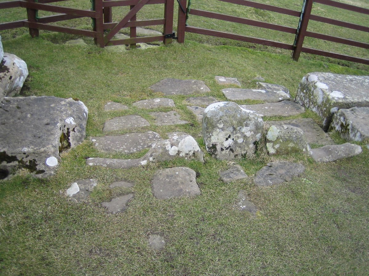
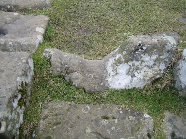
Below are wagon tracks worn into the stone paving of the east gate. The rising stone in the left picture is the stopper for the swinging gate doors. The right picture shows how three hundred years of wagon wheels rutted the stone. These grooves are 4' 8" apart, the same width as the railroad gauge used by 60% of the trains in the world. Coincidence? Not likely. This is the optimal span between the wheels of wagons pulled by a teams of side-by-side horses. The first railroad cars were pulled by teams of horses until locomotives eventually replaced them.[9]
 |
 |
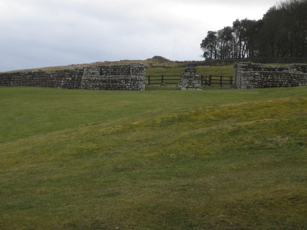
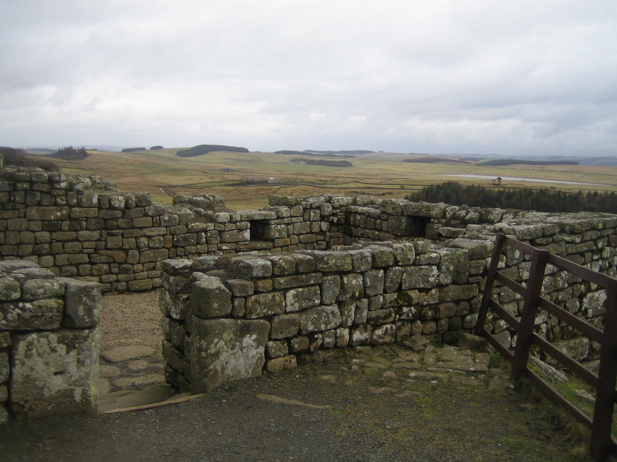
If the east gate was the formal entrance, the west gate was the back door where provisions arrived and were loaded into the nearby granaries. Shown below, Housesteads' west gate is among the best preserved of any on Hadrian's Wall. Notice especially the large blocks of the central pier intended as the inner support for a double arch.[28] Since this was the working entrance to the fort, where the grain carts brought supplies and returned empty, it's likely that both openings were used and one arch would not be bordered up as was often the case at some of the other gates.
 |
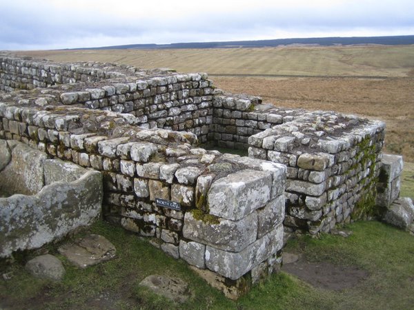
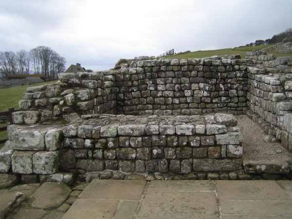
Below are two pictures of the North gate. The left shows the a gate room. The right shows both gate rooms with the central pier that would support the arches back to those gate rooms.
Most of the forts on Hadrian's wall were contained completely north of the wall, meaning that only the southernmost gate would be in civilized territory. Consequently, the south gate would often be the only one frequently trafficked and the others would fall into disuse. Because of the steep drop off from the Whin Sill, Housesteads Fort was positioned completely south of the wall -- making all of its gates accessible except for the North Gate.[9] However, the stones below the left arch of the North gate do show considerable wear from wagon wheels and a road was excavated opposite it that had been abandoned in the 2nd century.[16] What happened? Most likely when the road surfaces inside the fort were re-laid, the stacked floor stones made the resulting ascent into the north gate too steep for carts. Instead, a gate was added just east of the fort through Hadrian's wall at Knag Burn. Visitors from the North would enter at Knag Burn and then proceed into the fort through the nearby east gate.[36] This is one of only two known isolated gates through Hadrian's Wall; all others were at forts or milecastles.
 |
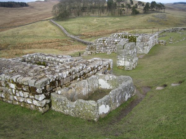 |
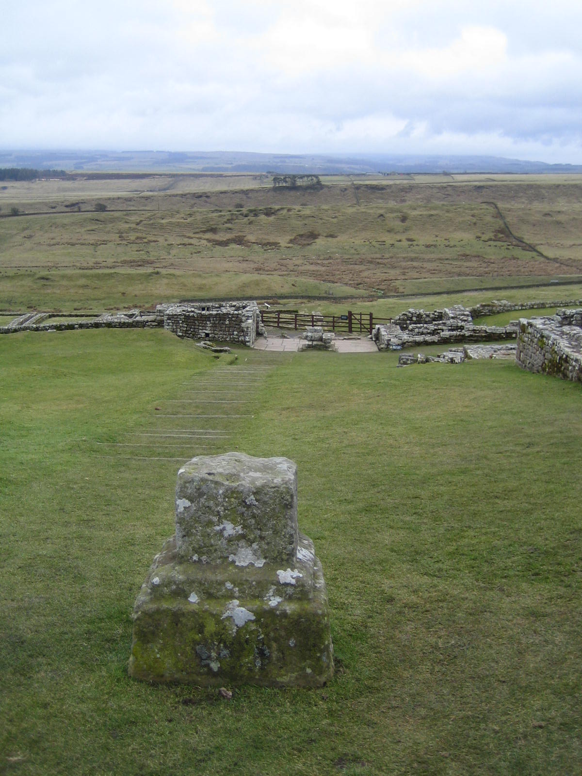
Below is a view from the center of the fort (the pillar is from the courtyard of the headquarters building) to the south gate and beyond. With a little archeological imagination, you should be able to construct a double arch over the central pier and the two gatehouses. In fact, the left gate was eventually blocked over, creating a blind arch. The pier blocks and many of the blocks used in the gatehouses were positioned by hoists whereas the smaller bocks in the fort walls could be moved by hand.
The fields beyond the gate are of some interest. Those white flyspecks are not lint on the camera lens but rather sheep safely grazing, as this area is now managed pastureland. Somewhere to the left is Chapel Hill where extensive religious artifacts have been excavated on the site of Roman temples. Underneath the fields of green are extensive remains of Roman (and perhaps prehistoric) fields. These may have been returned to cultivation in the later middle ages.[37]
 |
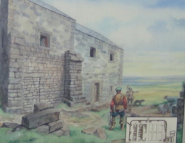
To the outside of the left tower was added a fortified farmhouse called a bastle house probably in the 16th century. These bastle houses (the word derives from the French Bastille) were built to withstand the raids staged by marauders common in this area during the wild times that lasted about 1200 years after the Romans pulled out in the early 5th century[50] Walls are about a yard thick. Animals stayed on the first floor. A ladder was required to get to the family quarters on the second floor, and it would be pulled up during a raid. Slate roofs resisted arson attempts. The picture at right shows how the remains at the left once looked.
 |
 |
Below is another picture of the bastle house. The stones were recycled from the fort but the masonry is quite different from that used by the Romans.[6]
 |
The south gate led to the civilian colony which supported the fort. We'll discuss that on our next page.
![]()
This
work is licensed under a Creative
Commons Attribution-NonCommercial-NoDerivs 2.5 License.