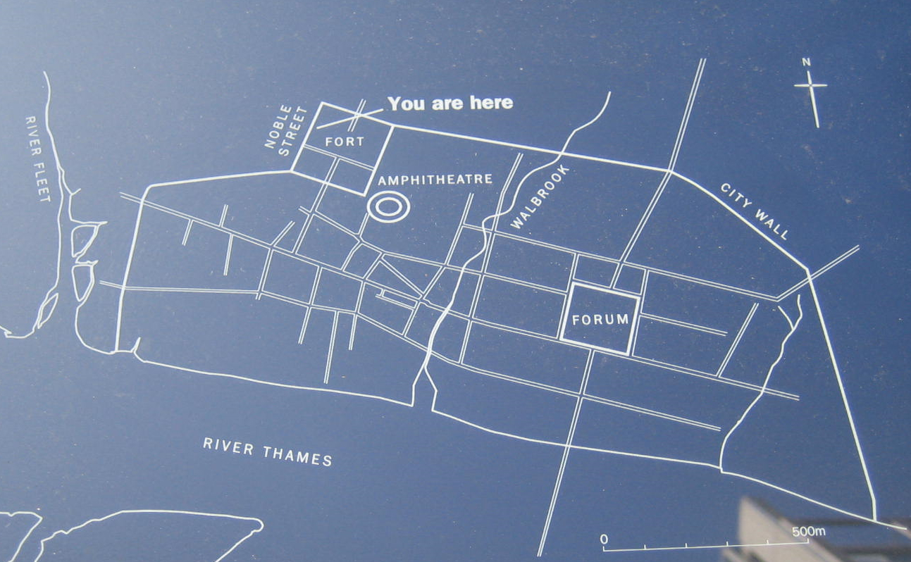
Our London Wall walk proceeds counter-clockwise from the Tower of London (about 4 o'clock) to Blackfriars (about 9 o'clock). Below is a map (displayed on the route) showing the position of the Roman fort (about 11 o'clock position) along the Londinium city walls that shaped the medieval city of London. Built around 110 AD, the fort preceded the walls by 90 years. Over 1750 boatloads Ragstone (a type of limestone formed around the village of Maidstone 120 million years ago when dinosaurs roamed) were shipped in from the Kent area up the Thames to construct walls about 20 feet high and 8 feet wide. The existing width of the fort walls were nearly doubled to match the new city walls. Two centuries later, the city walls were further strengthened and a wall at the river was added.
|
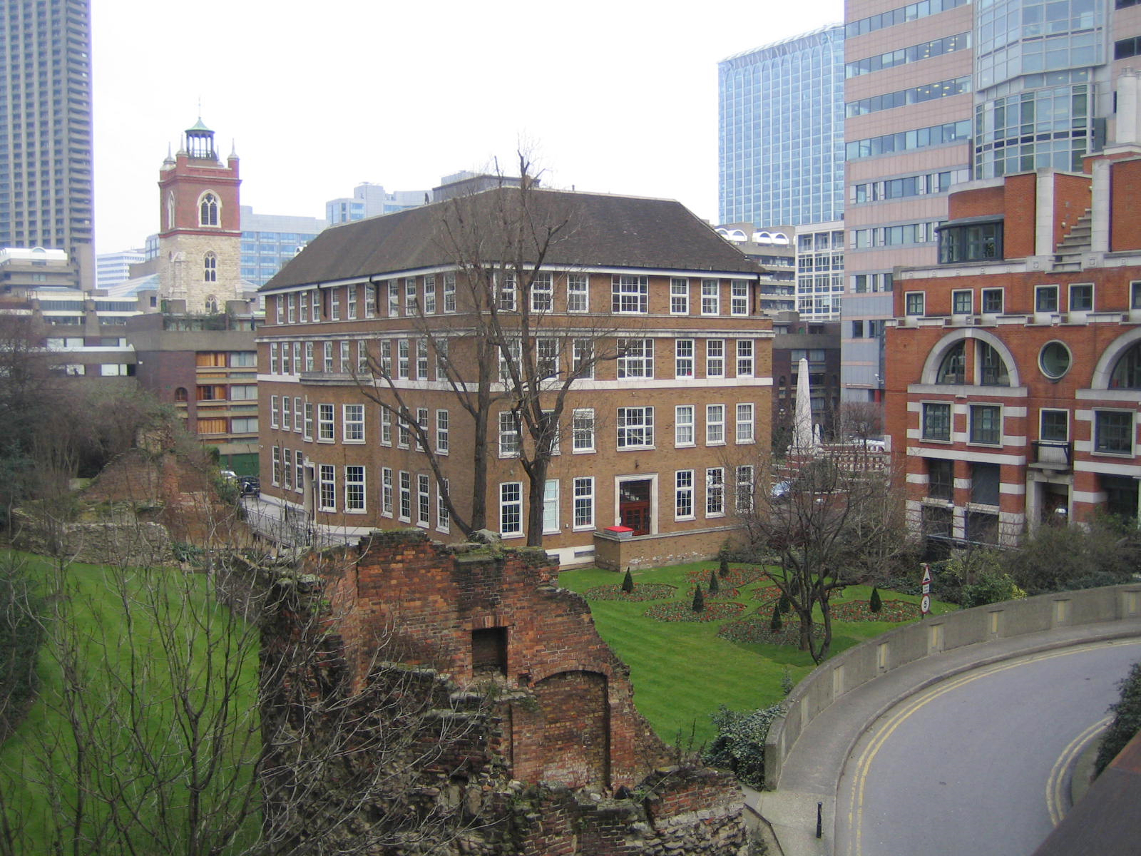
Below is a bastion added during medieval times to project outward from the wall so cannons could be aimed to protect the sides of the wall. This one is in the Museum of London area (the white building in the background. The museum itself not only provided the ceramic plaques for the wall walk tour, but has windows strategically placed to facilitate viewing the wall during inclement weather.)
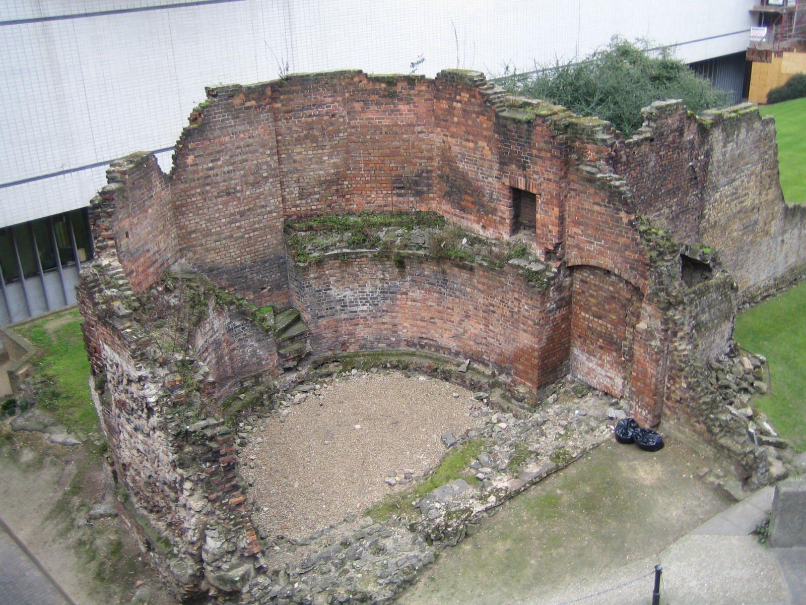 |
This is bastion #14 built during the medieval era. By this time, fortification were made round to resist battering rams (unlike the 11th century White Tower in the Tower of London which was built square like most Norman keeps). Look carefully to see the stairs leading up to the top. Some of the brickwork inside is more recent as are the garbage bags at right.
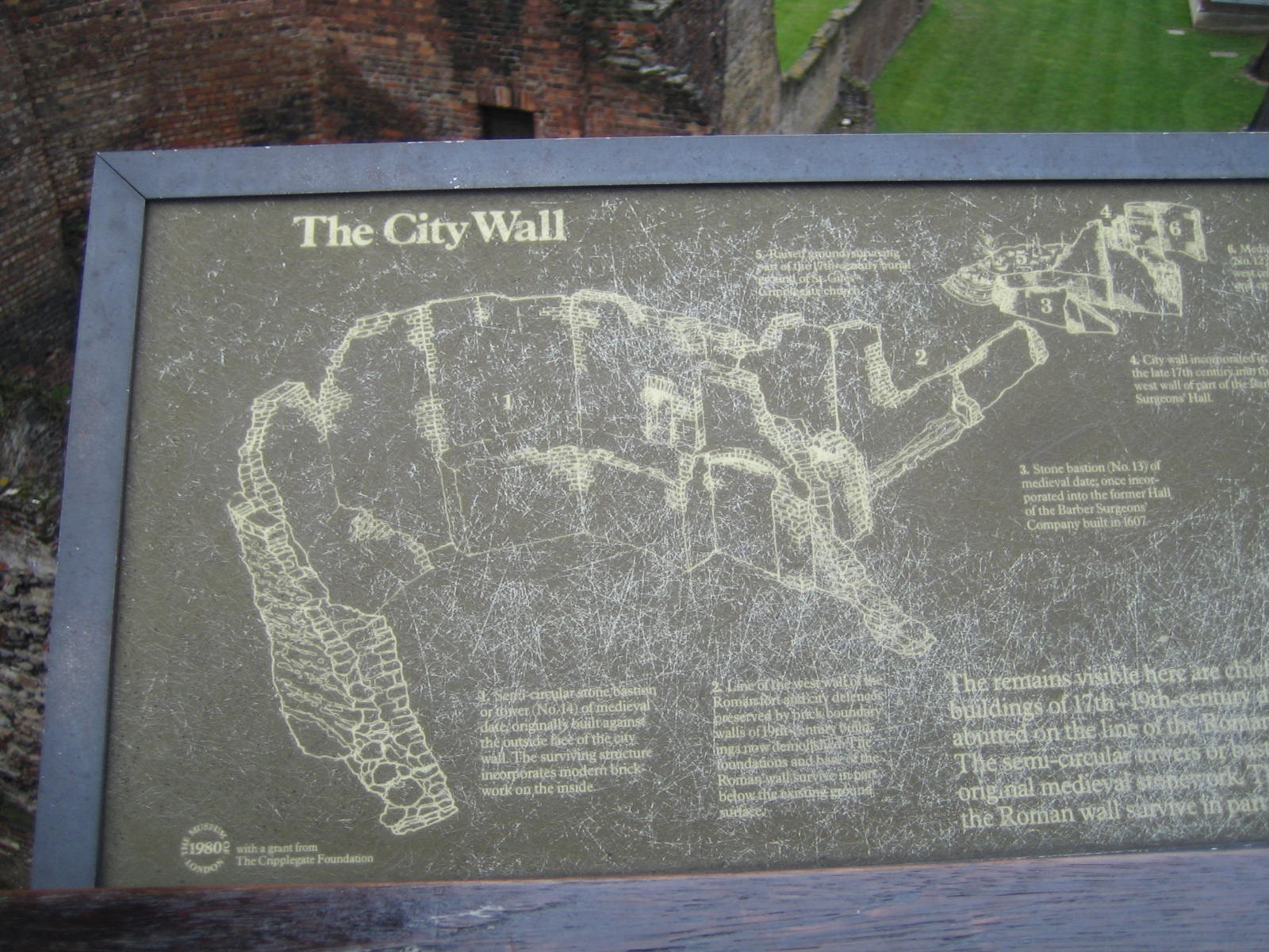
Below is a map showing where the bastions were added (the little half lifesavers stuck on the outer edge of the wall.) The Museum of London sits pretty much in the Roman fort's footprint.
 |
By the way, the shaded areas in this picture shows the damage done by German bombs during the World War II blitz. Pretty incredible. It makes the subsequent IRA bombing much less of a player in the architecting of the modern London financial district. However, if it weren't for those bombs, the Roman fort and the wall fragments in this area would not have been found and excavated. Remarkably what stands 1800 years later after massive modern bombardment is Rome's original ragstone walls.
Below is an example of what arose from the WWII ashes just in front of Christopher Wren's 1680 St Anne and St Agnes church (which was also extensively damaged by German bombs).
 |
If we think German bombs in the 20th century harmed the city (as seen in the shaded area of the map above), check out the damage by the Great London Fire of 1666 (which followed the Great Plague of 1665 which wiped out 20% of London's population. And we thought we had a hard time living through the 60's!)
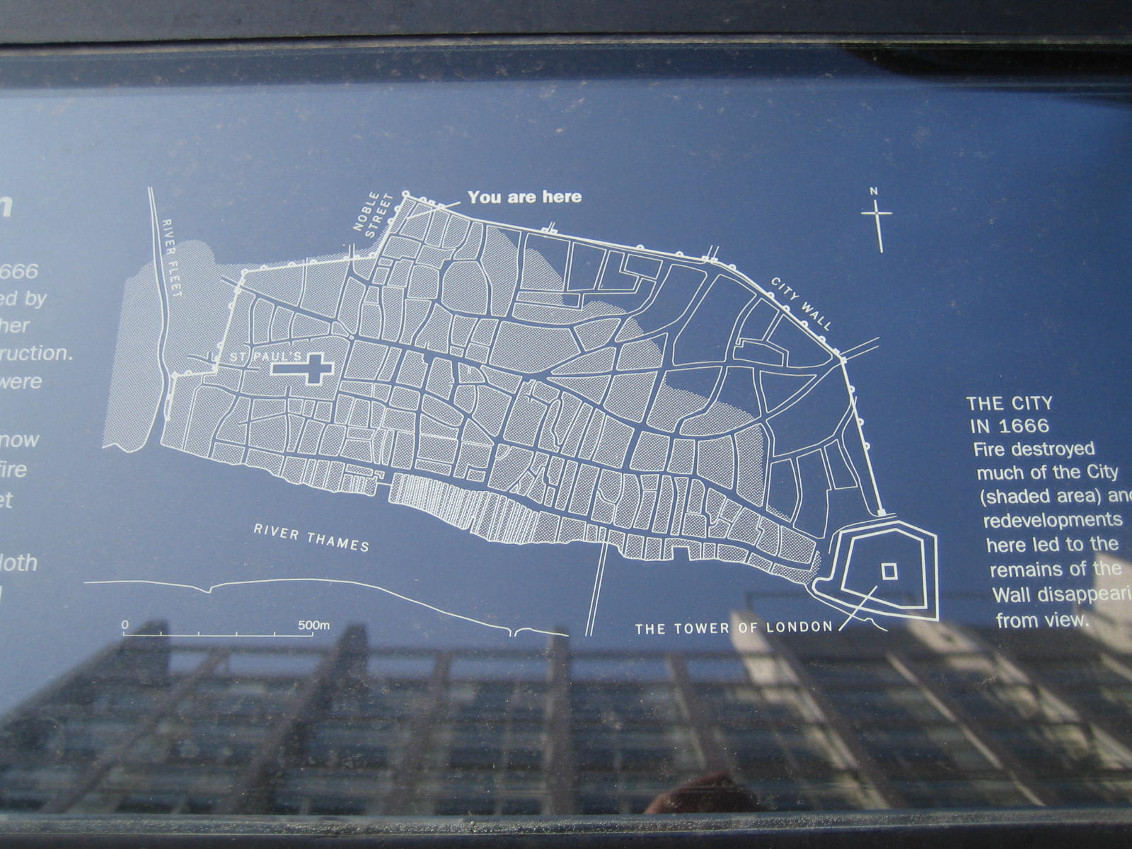 |
The shaded areas above show what the fire did. It stopped at the city walls which remained standing for another century until the residents tore them down to improve traffic flow. (Another way of stopping the fire was to use gunpowder to create a fire lane by blowing up houses.) Note also the reflection of the building in this reflecting sign. This is typical of the mid-rise modern architecture that surrounds this ancient site.
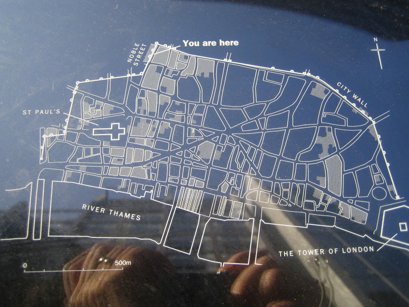
My favorite sign is the one below which uses etched glass to overlay the historic structure on the present ruin -- a superb job of graphic labeling that needs to be followed elsewhere where Roman ruins poke through British soil such as at Housesteads Roman Fort on Hadrian's wall.
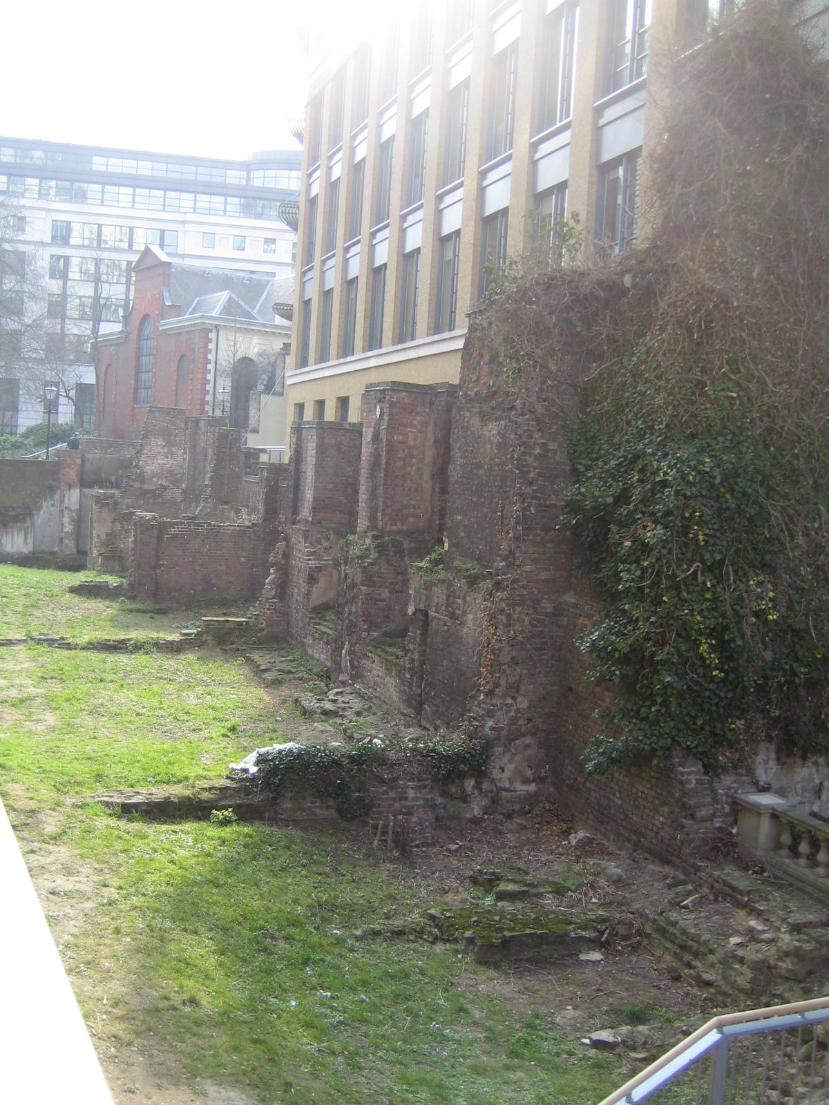
Here's what this area looks like without the etched glass overlay -- just not the same. It takes a clever viewer to figure out what the Romans really built from just looking at the remains. Would you know that we are looking at two crenellated turrets without the above sign?
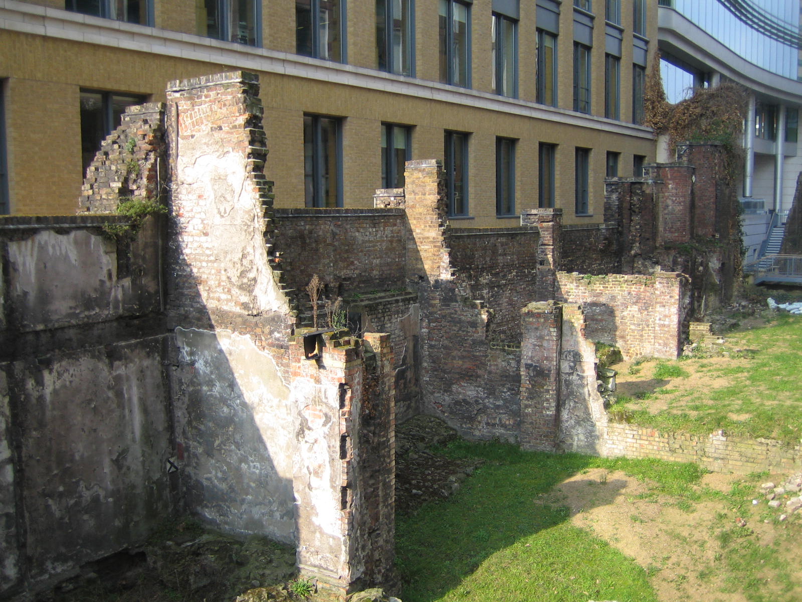 |
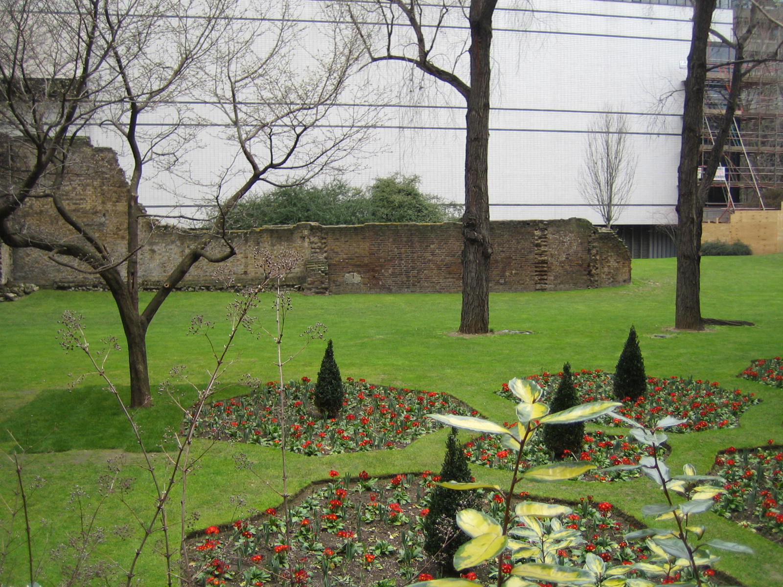
The Museum of London (white building below) has many examples of the old city walls around it in a landscaped garden, creating an 1800-year-old sculpture garden. Here's some shots:
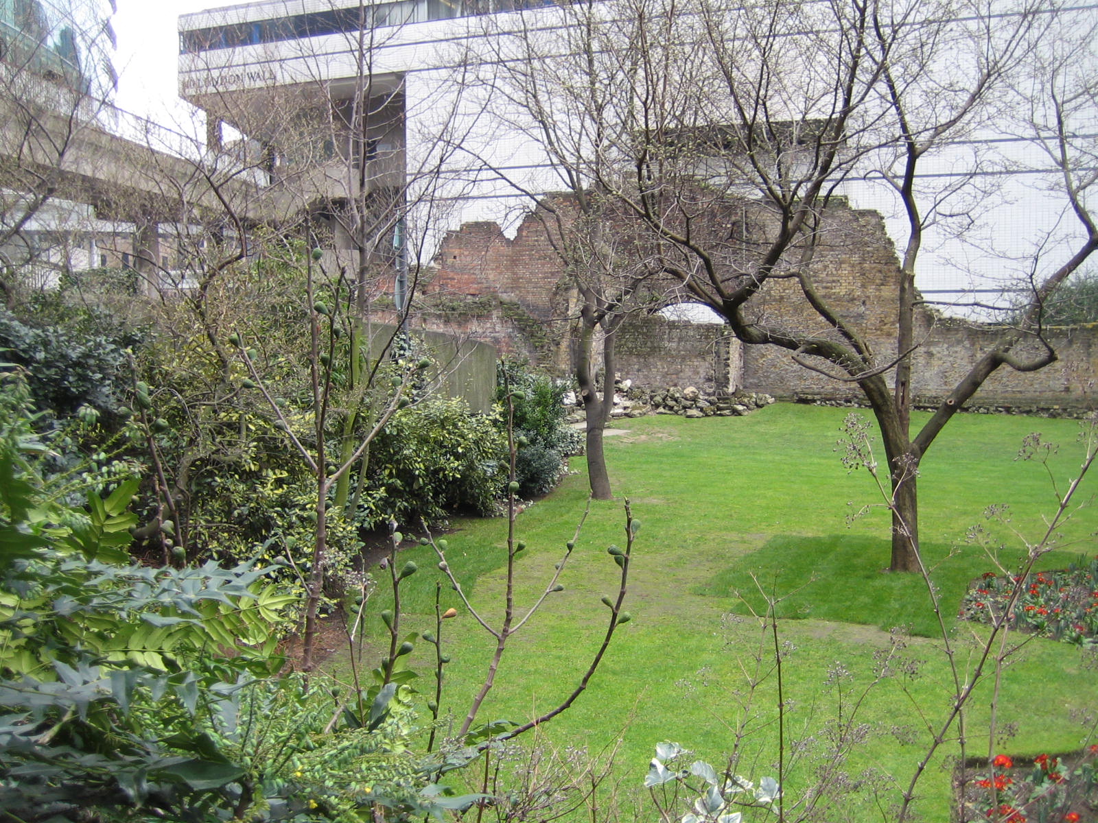 |
The museum building sits on London Wall road -- a new road constructed after the Germans leveled the area and inadvertently excavated the walls.
 |
Many buildings (since bombed or voluntarily demolished) used these city walls as part of their structure; for instance the wall above was incorporated into Surgeons Hall -- a precursor to the AMA, I suppose.
Here's another view showing what appears to be the new Surgeon's Hall (the old hall was the Barber/Surgeon's hall since it was built before surgeons decided to break their guild away from the barbers. Those doctors!)
 |
![]()
This work is licensed under a Creative
Commons Attribution-NonCommercial-NoDerivs 2.5 License.