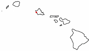
Ka'ena Point -- The Northwest Edge of Oahu
Visited 9 January 2007
Ka'ena Point -- The Northwest Edge of OahuVisited 9 January 2007
|
|
Where the Waianae mountain range meets both North and leeward shores |
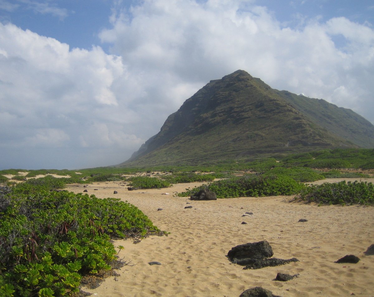
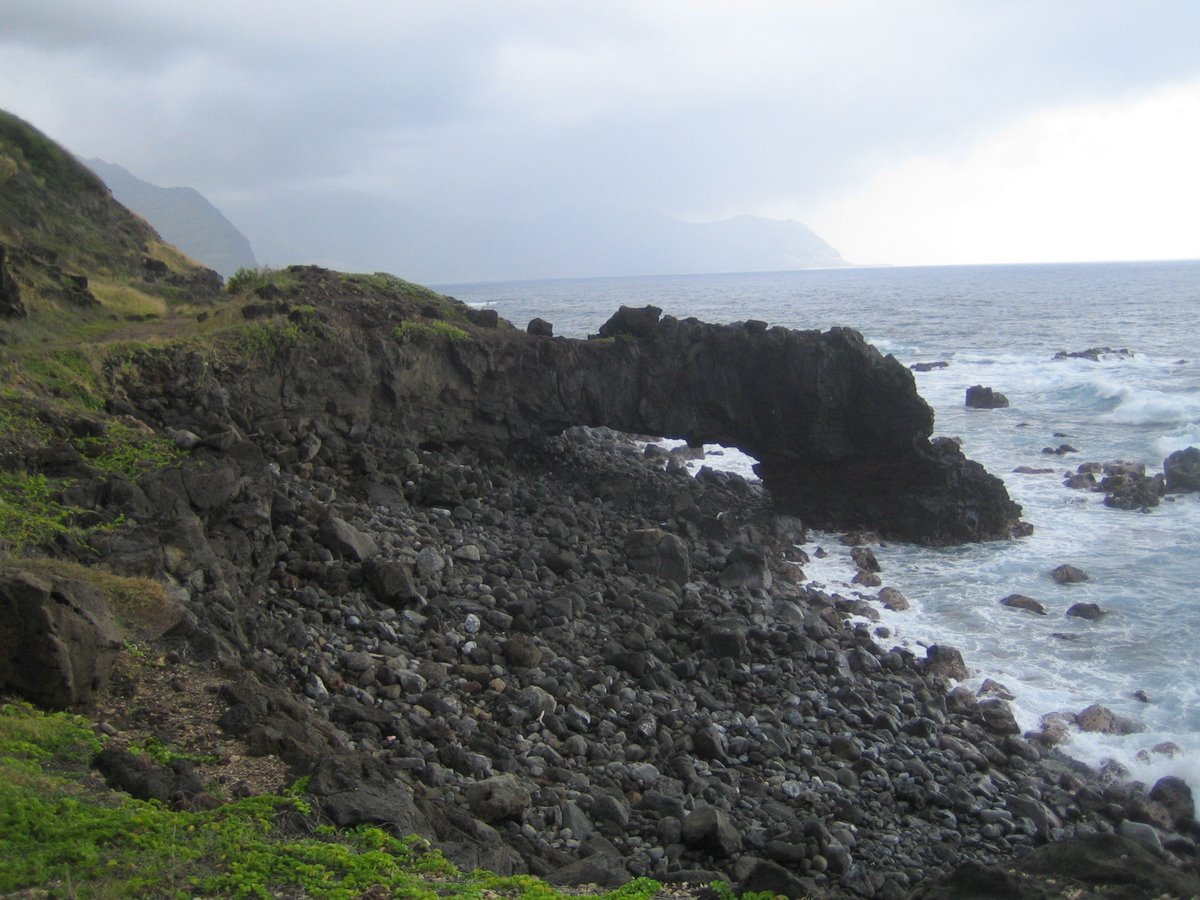
Many visitors to Oahu see only Honolulu airport and Waikiki Beach and think of the island as civilized (or at least commercialized). Here's another view, the opposite end of the island at its Northwest tip, called Ka'ena Point, the last wild stretch of coastline in Oahu. Ka'ena means "the heat" in Hawaiian. Heat wasn't a challenge for us, but showers and sunlight took turns assaulting our foursome fearlessly hiking the five-mile round trip from Yokohama Bay north through lava, through decaying vehicles and discarded trash, through the sand, and through the nesting Albatross to the Point.
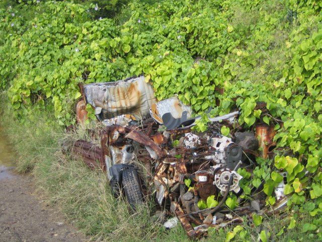 |
While many Oahu maps show Route 93 merging seamlessly into Route 930 as it rounds the Point, both the southern and northern roads end several miles before Ka'ena Point. The southern approach is speckled with the rusting carcasses of cars that have failed to make the trip, such as the one on the left. Its driver obviously believed the map. The trail was once more manageable. In fact, the O'ahu Railway and Land Company once transported sugar cane around the point until 1947. (Cross timbers still show through the muddy trail in spots and nearby Yokohama Beach was named after a railway worker.) On the left below, note how the eroding roadway was literally shored up, perhaps by the prisoners that built a dirt road here from 1954-56 after the railway left. The Transportation Department proposed paving that |
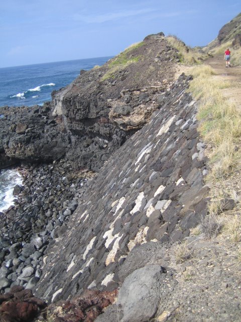 |
While the left photo shows a reinforced trail the right shows where the sidewalk ends. This washout was created by erosion and creates a natural barrier for recreational vehicles approaching from the South. A vehicle barrier was constructed on the North approach. [Update: later in 2007 the path around this spot was restored.] |
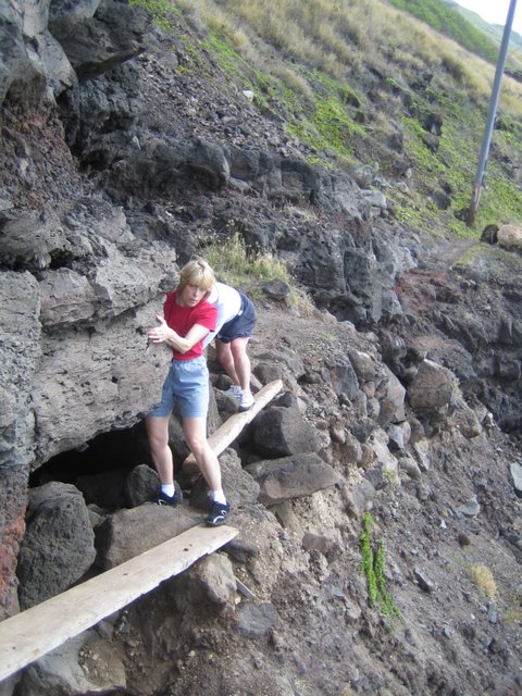 |
Coming from the south, the major barrier protecting the point is the missing trail seen on the upper right and in the picture below. Think twice before traversing those narrow boards -- but don't look down:
 |
Apparently such washouts were common. The railroad would keep a contingent of workers in nearby Makua to quickly repair damage done by the rough winter surf at Ka'ena point1.
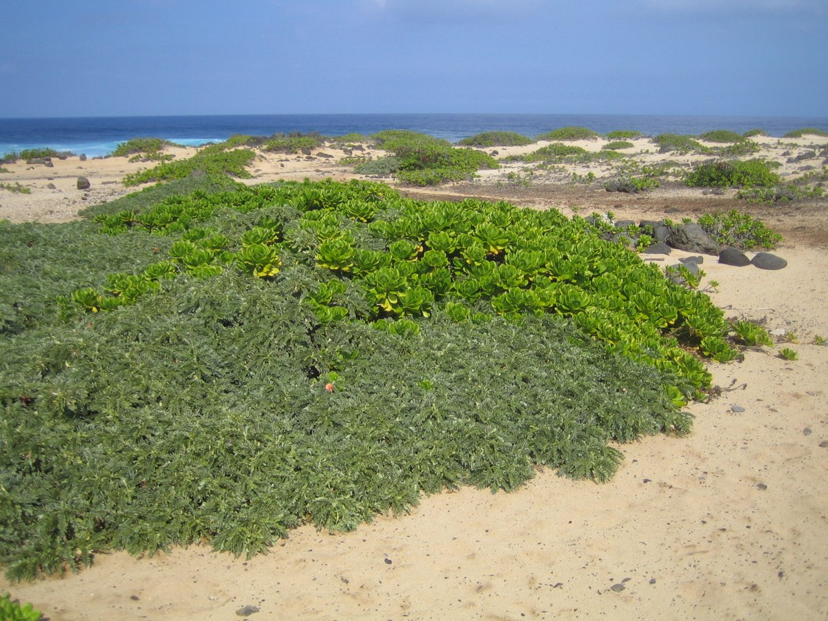
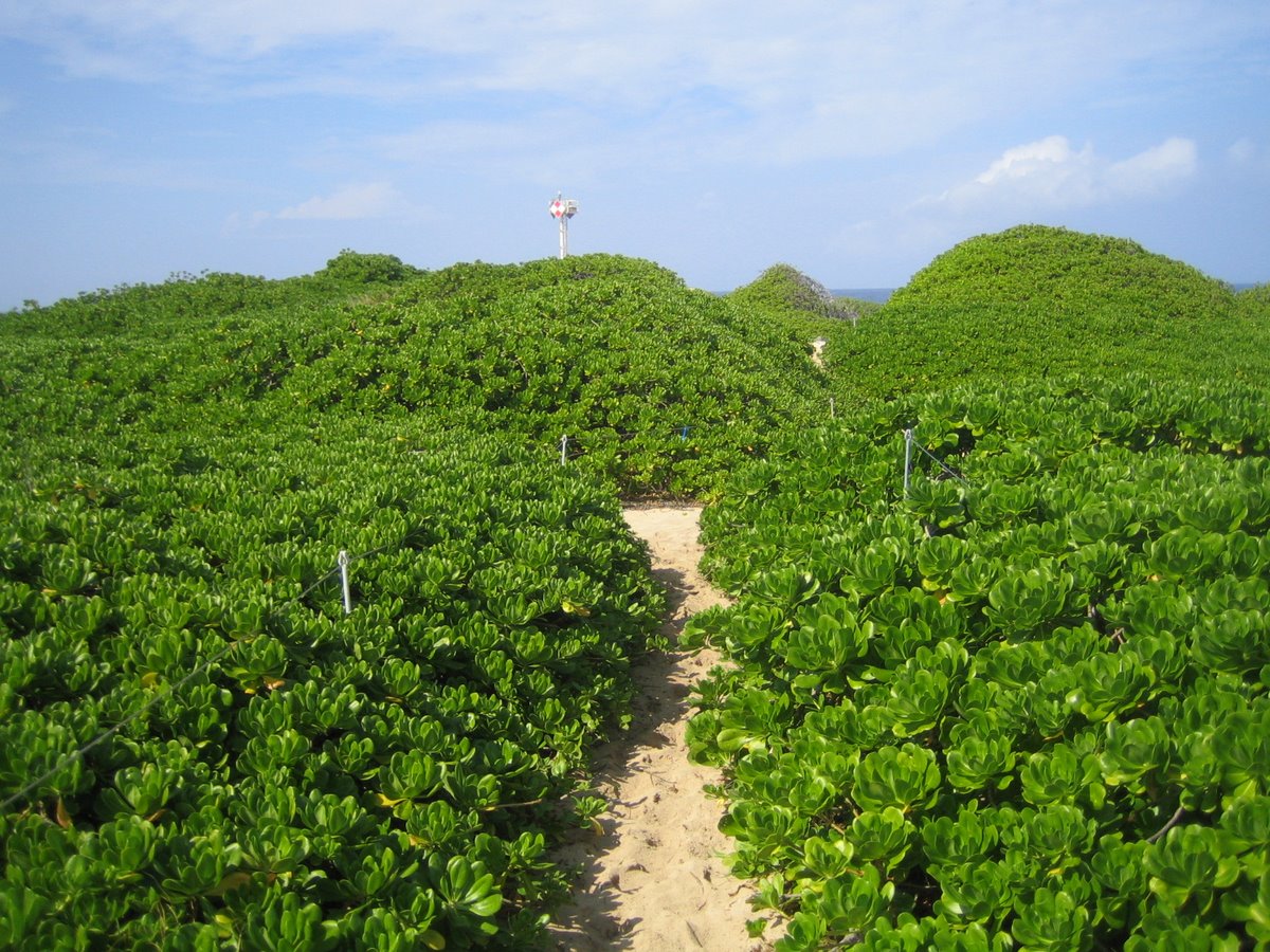
The prize beyond the boards spanning this natural washout are the dunes. Once many Hawaiian islands sported such dunes, but the arrival of man forced them into retreat. Ka'ena Point's threatened dune coastal ecosystem is one of the last on the major islands and its deliberate inaccessibility provides it with a chance to recover from the recreational-vehicle abuse of the past decades. The photo below shows a typical swath of dune at this point, held in place by rare Naupaka Mixed Coastal Dry Shrubs, once the best example of Naupaka on Oahu before the recreational vehicles restructured it. Ain't freedom grand!
 |
About this time of year, Humpback whales breed in the waters of this area but did not announce their presence to us. (Maybe we were looking at our feet too much to see a mere 50' whale?) While we missed them, we did spot a seal on the beach at the Point, perhaps one of the rare Hawaiian monk seals, the most primitive and most endangered of all the world's seals. This and other true Hawaiian species have habitat here.
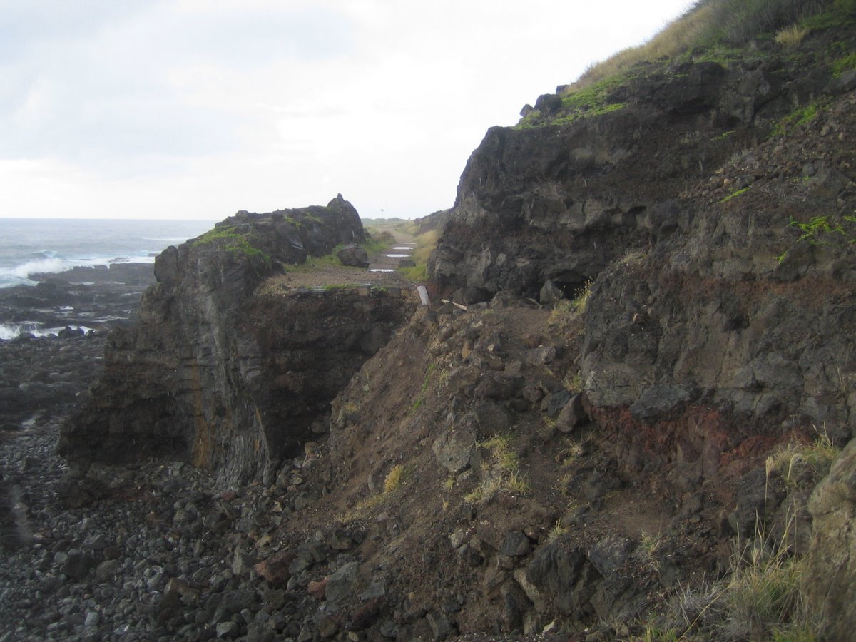
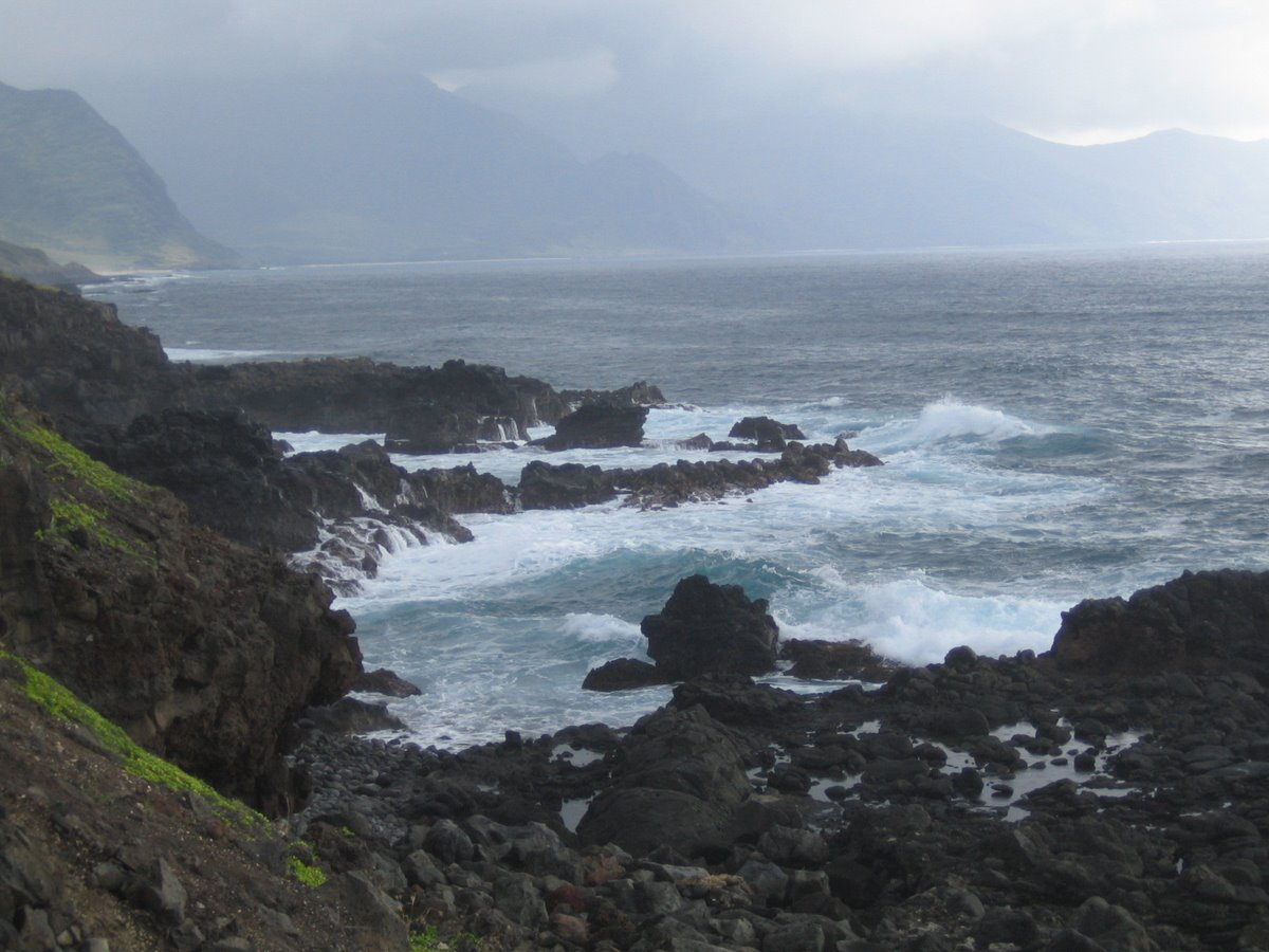
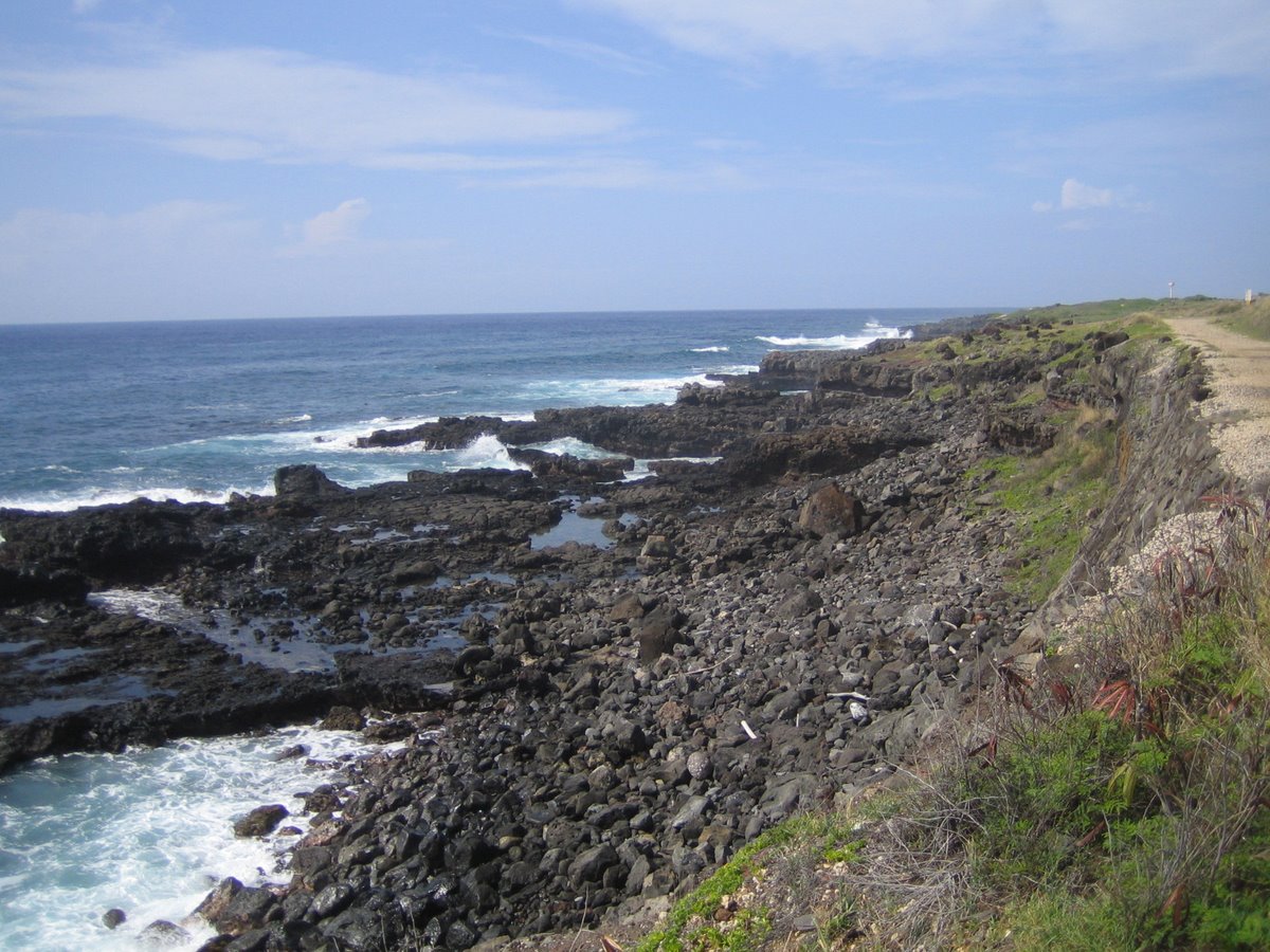
Most of the south approach to the Point is not scary. In fact, it's a visual feast of crashing surf against lava rock. Here's two shots of the hike in on the south approach from Yokohama Bay:
 |
 |
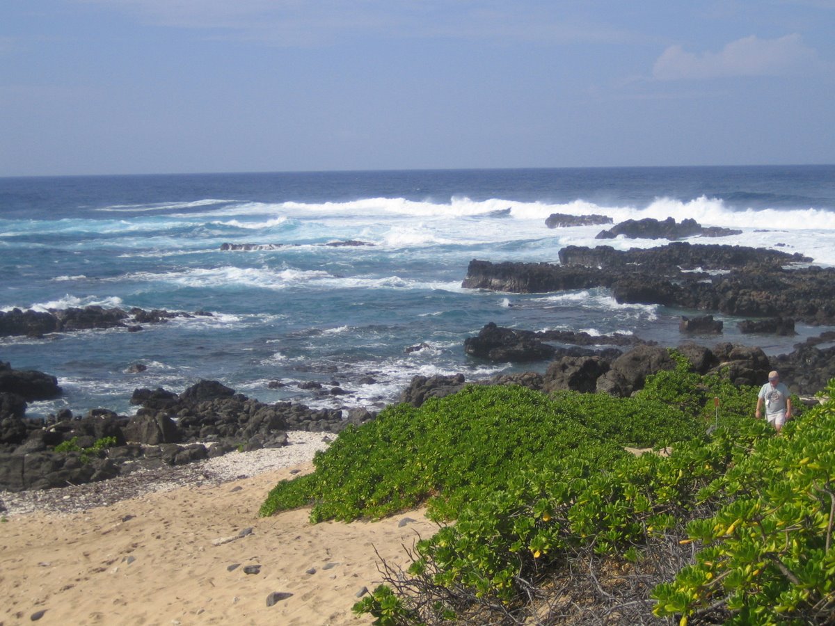
Here's a few of the beach (what little there is) once you arrive at Kaena Point:
 |
 |
Swimming is pretty hazardous here as huge North shore winter waves crash onto limb-eating lava. But we did find a couple in one of the more protected pools (see the auxiliary pictures linked at the end of this page). This area can be assaulted by gigantic surf (rumored to be up to 50 feet high and some from swells starting on Alaskan shores).
But we're getting ahead of ourselves. Let's back up to the place where you cross those toothpick-wide boards suspended precariously over the surf-smashed lava far below. (The boards get narrower and the altitude increases with each telling!) Once you've negotiated passage you are presented with this easy and scenic hike to the lighthouse (that tiny little speck at the far right):
 |
As you near the Coast Guard tower the dunes rise up, held together by Naupaka bush. Hiking between the wire trail edges at this point is a bit tedious in thick sand with heavy boots:
 |
But that gives you reason to stop and recite the "Rime of the Ancient Mariner" to the Laysan Albatross nesting here. That tended to put them to sleep, not unlike my high school English students decades before. (OK, this is a bit of diversion, but that old poem was inspired by the voyage of Captain Cook who discovered these islands. Perhaps it's remotely possible that nearby ponds held turtles who were babies when Cook arrived or when Coleridge wrote. You can live a long time if you just relax all of the time in Hawaii.)
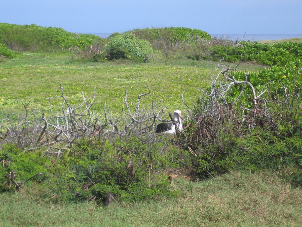 |
Relaxing is what the Albatross should be doing in her protected nesting grounds. Albatross nest on islands that had been historically free of land animals (like Hawaii was before the Polynesians brought pigs in their outriggers.) Albatross like Kaua'i better than Oahu (don't we all), but have been increasing in this area since the reserve was established. Pairs bond for life and take a year to produce a fledgling out of a single egg. With luck s/he will eventually have a wingspan of 11 feet and may live 50 years. No tortoise, but not a mayfly either. Of 21 Albatross species, 19 are threatened or endangered. Now that they are at risk, we no longer call them Gooney Birds.
Speaking of Gooney, check out the Coast Guard station below: (If you PC users push your PF11 key, you might be able to get the whole picture on your screen, not that this is the most beautiful scene in Hawaii).
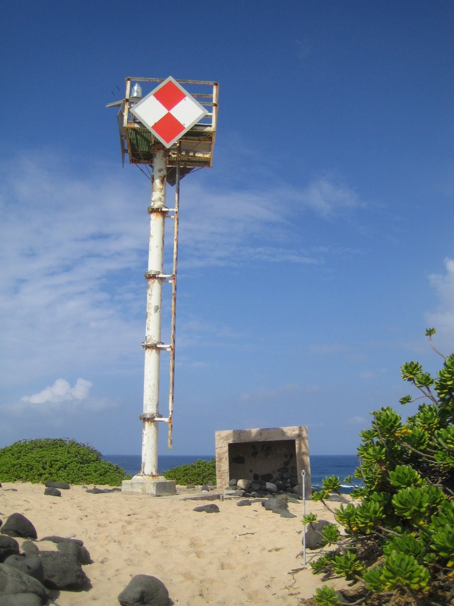 |
The rectangle at right is probably the old station now tipped over after being undermined by erosion. (Not just teenagers leave their trash here.)
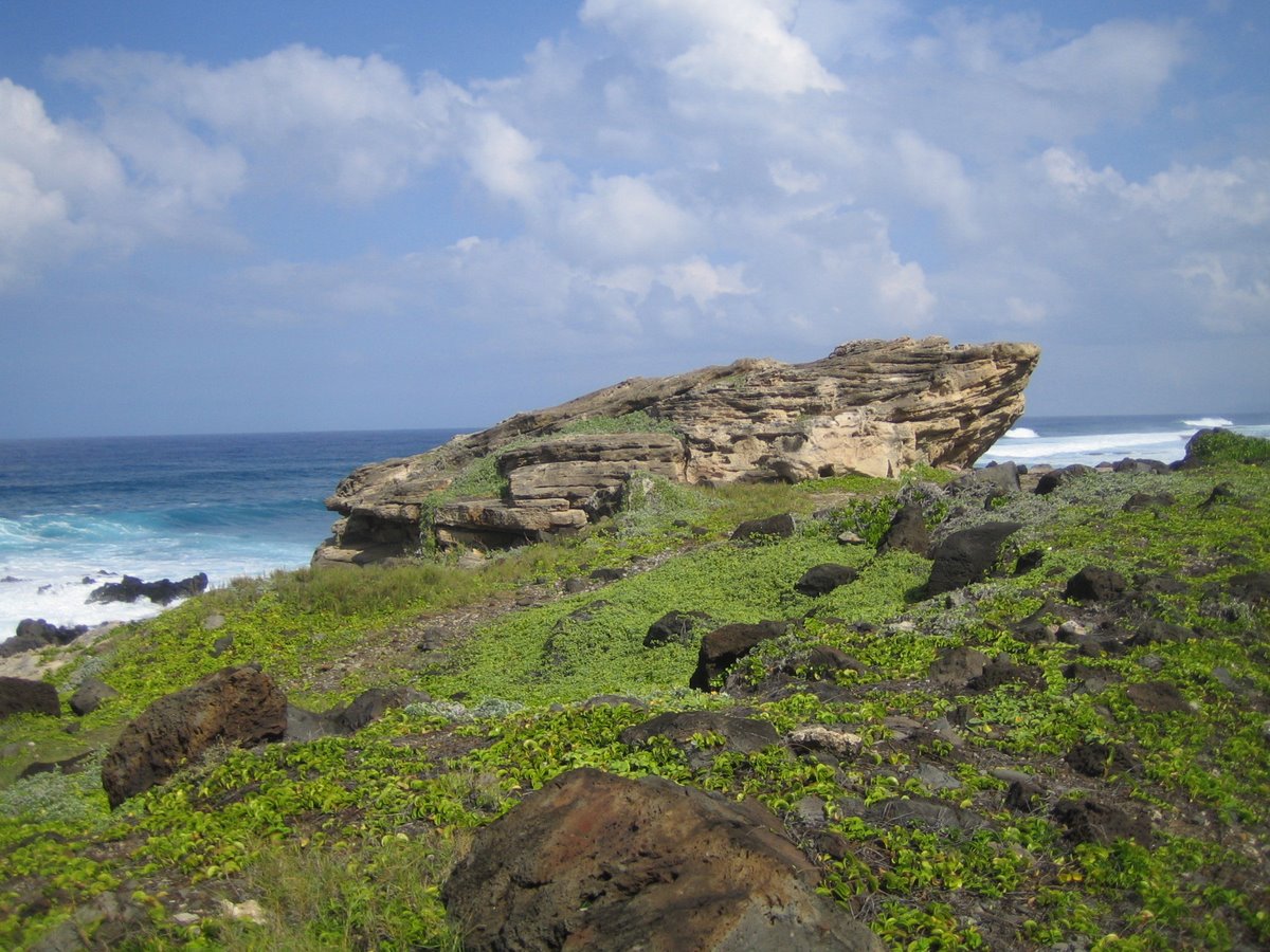
After turning the corner, we proceeded about a half mile along the north shore to visit the layered sandstone rock called Pohaku o Kaua'i which means the rock of Kaua'i. Legend has it that this rock was thrown by one of the gods from Kaua'i (about eighty miles away) to this Oahu shore. The area around it is called Leina-a-ka-'uhane which means the leaping place for souls. As you lay dying, your soul left your body and wandered about aimlessly until it climbed this rock and leaped into the ocean -- to be caught in mid-air by its ancestors. When that happened, you then died. As this is the most western part of the island, it's where the darkness starts -- the place (called Po) where souls wander with their ancestors in the dark. The other populated islands also have their leaping places in the far west where sunsets usher in the night.
 |
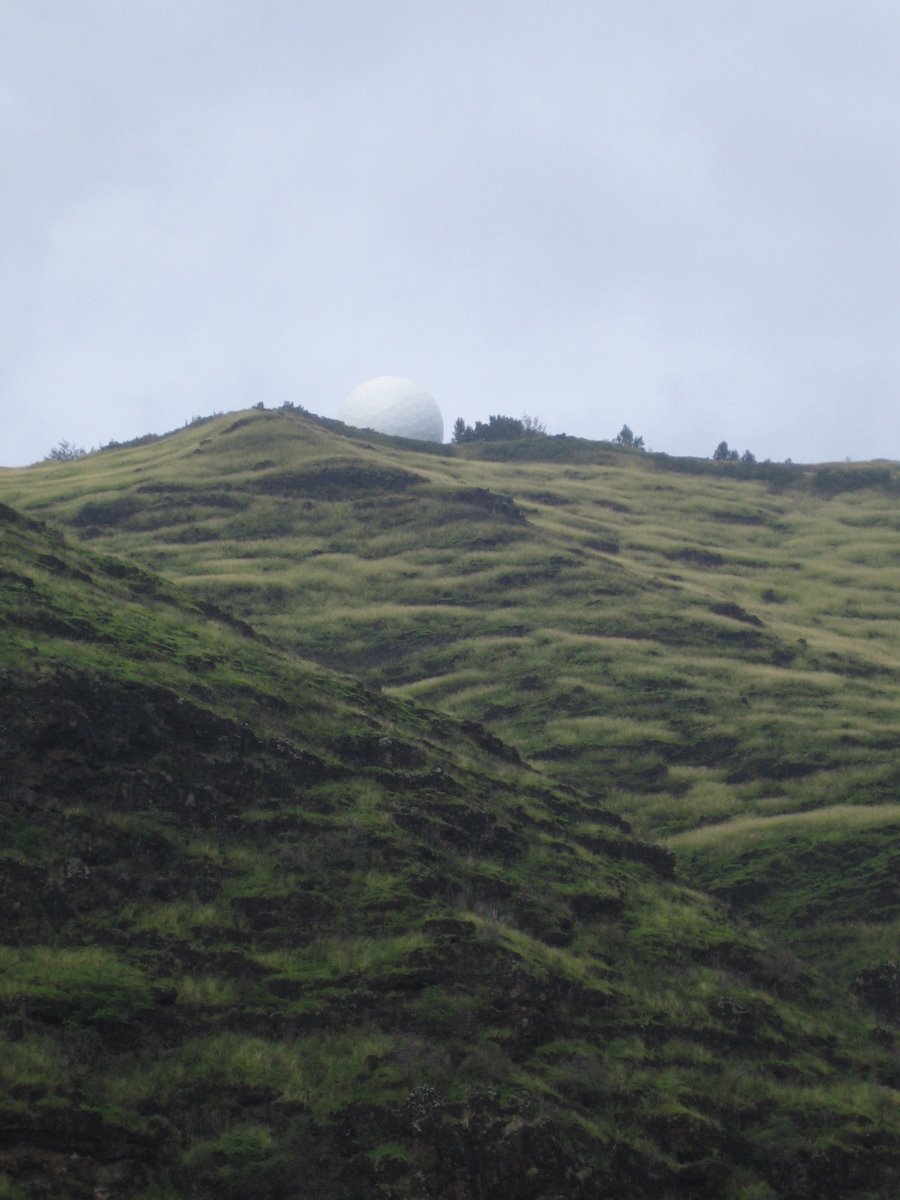
If that sounds weird and you're about to make snide remarks about stone age cultures, try this, you technophiles: The picture below is not of a great golf ball (not the Go'lf Pohaku o O'ahu) about to roll down on us at the parking area on Yokohama beach. Au contraire, it's a radome (a radar dome) of the Kaena Point Satellite Tracking Station that facilitates Defense Department satellites (and about 500 ICBMs if you really want to get scary). From 1959 through 1972, the hyper secret CIA Corona Project put satellites with with 70-millimeter cameras into orbit to take pictures of our friends --and their missiles-- in China and the Soviet Union. This equipment only took pictures -- networks in those days were too primitive to transmit much detail. So the gadgets put the pictures in bottles and cast them out to sea. Not quite! Instead, pictures were put in a capsule and dropped with the expectation that an Air Force plane (dispatched from here) would snare them in mid-drop. If not, the capsules would float for a few days until the brown sugar used to plug a big hole disintegrated, thereby sinking the capsule and keeping it from enemy hands. Even though only 3 of the first 25 capsules were recovered[93], 145 satellites were launched before the program terminated in 1972 after we noticed a Soviet sub waiting at a scheduled drop site.
Now that we told you, we'll have to kill you. (Like the CIA, Hawaiians also had human sacrifice but stopped it in the early 19th century.) Not to worry, Clinton declassified the photos in 1995 so you won't have to buy a pardon from him (or maybe her).
 |
We can't show you the Corona images, but if you'd like to see scads more pictures from Ka'ena point, click here.
![]()
This
work is licensed under a Creative
Commons Attribution-NonCommercial-NoDerivs 2.5 License.
Note 1: attributed to John Clark by Honolulu Advertiser, September 2, 2001